Perusing maps has always been a favorite pastime of mine. The love of maps was definitely inherited from my Dad. When I was traveling a lot for my genealogy business, he would call me before I left, and with his maps on his desk, to learn about my route. One day I brought him my Hammond World Atlas to show him more maps. He tried to keep it. We eventually found him a newer copy at Half Price Books. I inherited that copy to replace mine that has pages falling out.
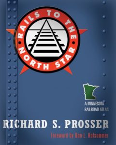
Then when I began researching and lecturing about railroads, records, and maps, my love of maps grew more addictive. One of my favorite railroad map guides is Rails to the North Star: A Minnesota Railroad Atlas. It was compiled by Richard S. Prosser with a foreward by Don L. Hofsommer. (Reprint edition is published by the University of Minnesota Press, 2007.) The guide is available in libraries, historical societies, bookstores, the U of M Press, and other online dealers. North Star? Minnesota is the North Star state, and this book has 283 pages, is indexed, has Minnesota railroad history, legal statutes, summary of railroad companies that operated in the states, and maps. Maps. Maps. Maps.
I immediately recognized Hofsommer as the author of many books and articles about a variety of railroads from Minnesota and beyond. Prosser’s name was new to me but I knew to have Hofsommer’s endorsement was big! I used this guide a few days ago to tell a colleague what railroads to look at for Blue Earth County, Minnesota as she traced the movements of her family.
Where else to look for railroad maps for your ancestral areas? These should get you started:
- Histories of railroads in a specific state, province, county, or other jurisdiction.
- Map guides for specific railroads.
- College and University map libraries.
- Library of Congress maps https://www.loc.gov/collections/railroad-maps-1828-to-1900/about-this-collection/.
- David Rumsey Map Collection https://www.davidrumsey.com/luna/servlet/view/all/what/Railroad/.
- CyndisList https://www.cyndislist.com/railroads/maps/.
© 2022, Paula Stuart-Warren. All rights reserved.