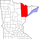
“The monument markers were originally set by U.S. government surveyors in St. Louis County from about 1850 to 1911 — guys in wool hats and plaid shirts carrying chains and a compass and a notebook. They camped in the woods and had little communication with the outside world — but took very good notes that have been preserved to this day.”
I have used many of those notes and maps while doing land research and also out of historical curiosity about material in the Minnesota State Archives in Saint Paul. The wealth of land-related records there is amazing. Other states have some of these same records.
The quote above is from a fascinating article in the March 31st Duluth News Tribune.
To learn more about land records at the Minnesota Historical Society and State Archives, visit www.mnhs.org/ and look several ways:
- In the upper right hand corner of the MHS website’s main page, do a variety of searches using key words such as land records, original land surveys, public land surveys, state land office, and be prepared for a wealth of finding aids for materials at MHS and also for links to land-related articles in Minnesota History.
- On that same main pages, under the Research tab, click on Library Catalog and being a search using some of those key words. Add place names for specific locations, too.
- Under that research tab, also click on Archival Collection Finding Aids and Research Guides by Topic for more information on a variety of land-related topics.
- I have my own well-read and marked copy of A Guide to the Records of Minnesota’s Public Lands by Gregory Kinney and Lydia Lucas (MHS, 1985). That guide is online here.
© 2018, Paula Stuart-Warren. All rights reserved.
My daughter is a surveyor and gets very excited when she finds old surveyor’s markers.